Vietnam Budget Tours
Duration: 10 Days/9 Nights
Price from: $670
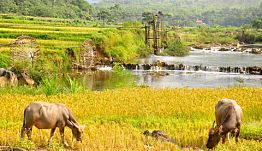
Vietnam is located on the eastern seaboard of Indochina peninsula, sharing common borders with China in the north, Laos in the west and Cambodia in the south-west. To the east and south lies the East Sea. Mountains and hills cover four fifths of Vietnam's territory with Truong Son range (Annamite moutains) stretching over 1,400 km. The highest roof of Indochina is Fansipan mount (3,143 m above sea level).
Vietnam side/ China side
From Laos: Vietnam side / Laos side
From Cambodia: Vietnam side / Cambodia side
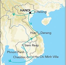
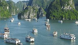
The most populated areas in Vietnam are the Red River Delta and Mekong Delta which form 02 rice baskets for the country. There are, along 3,444 km coastline, wonderful beaches like Lang Co, Danang, Hoian, Nha Trang, Qui Nhon, Phu Yen, Muine - Phan Thiet, Vung Tau, Phu Quoc Island and Con Dao Island. Vietnam is rich of national parks Cat Ba, Ba Be, Cuc Phuong, Pu Luong in the north, Ke Bang, Bach Ma in the center, Cat Tien in the south.
Duration: 10 Days/9 Nights
Price from: $670
Duration: 3 Days/2 Nights
Price from: $189

Duration: 6 Days/5 Nights
Price from: $205
© Cosmos Travel Vietnam Co.,Ltd. All rights reserved.